Android
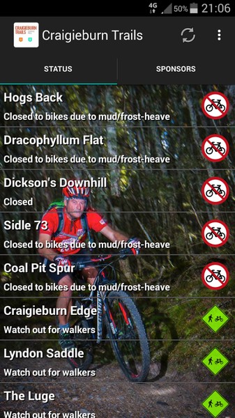
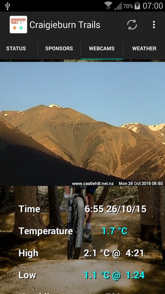
The Craigieburn Trails Android app provides up-to-date information on track status within the Craigieburn Trails network. An in-app donation (choice of amount, with all proceeds going directly to track maintenance and development) will unlock detailed maps, elevation charts and track descriptions for each trail in the network, along with Castle Hill webcams, and current & forecast weather conditions.
Please be aware that the track map and elevation functionality require an initial data connection; if you’re heading into an area of the Craigieburn Forest Park which has patchy coverage, simply visit the track details for the track you’re interested in while you still have coverage and the data will be cached for offline use.
You can check mobile coverage in the Craigieburn Basin on the Vodafone website.
App development by Conor Boyd IT
iOS
The app provides:

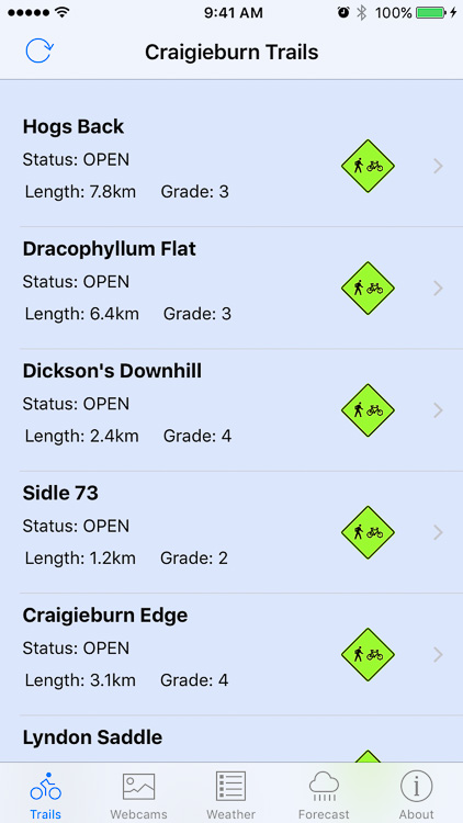
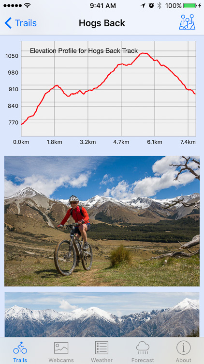
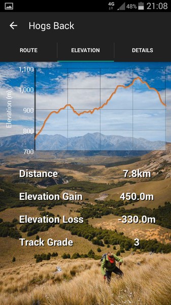
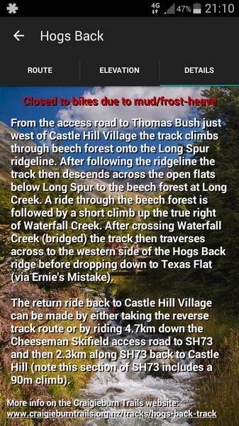
- information on each trail within the Craigieburn Trails area (open/closed status, description, map, elevation profiles and photos),
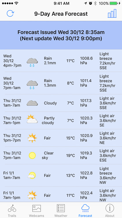
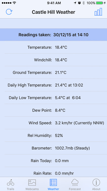
- current weather conditions in the Castle Hill Basin (readings updated every 5 minutes),
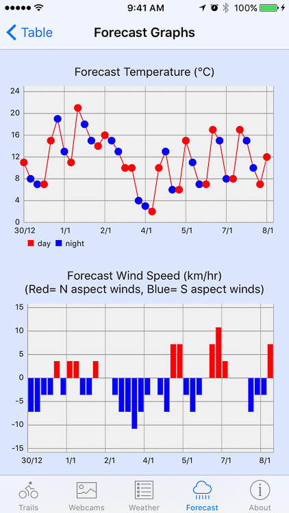
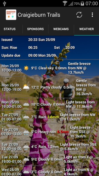
- a 9-day weather forecast for the Castle Hill area.
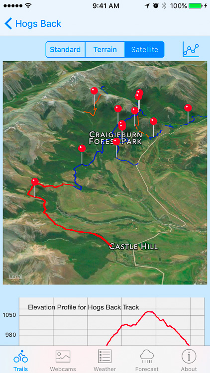
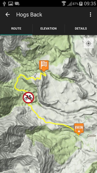
Trail descriptions, length, grade, altitude gain and loss for each track, as well as elevation profiles and a route maps, can be viewed by selecting a name from the list. The map and elevation graph will actively track your position while you are on any particular track. Options are provided to view either the standard Apple system map, a satellite image map or a topographical map. (The topo map format can be specified to be either NZTopo50 or Open Street Map set using the app settings in the iPhone Settings). (Note that the internet connection signal within the Craigieburn Forest area can be ‘variable’ to non-existent. The app will happily run in ‘offline’ mode but the standard and satellite map views do rely on the iPhone system caching and will only display if they have been previously viewed with an active internet connection. However, the topo map view is separately cached and will always display with or without a phone signal even if it hasn’t been previously viewed.)