Map
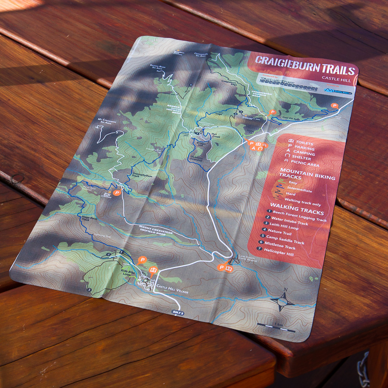 Proceeds from these items go directly towards building and maintaining the tracks. The essential guide to the Craigieburn Trails in a beautifully presented package, this map is printed on a soft micro-fibre cloth which is also perfect for cleaning your riding glasses, before scrunching up in a little ball and stuffing up your sleeve or alongside your hydration pack. The front of the map clearly shows all the main tracks in Craigieburn Forest Park and through to Castle Hill Village, including all the details you need for how to find your way to the individual tracks. The back of the map shows the location of the Trig ‘M’ tracks, along with with walking and biking distances & times. Read more here, or buy your maps in our online shop (buying direct from us means maximum benefit for trail maintenance and development).
Apps

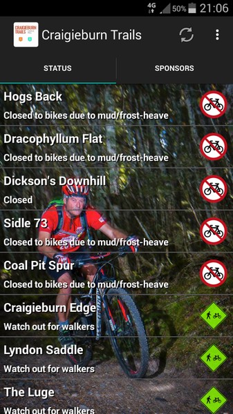 The Craigieburn Trails Android and iOS apps provide up-to-date information on track status within the Craigieburn Trails network. For the Android app, an in-app donation (choice of amount, with all proceeds going directly to track maintenance and development) will unlock detailed maps, elevation charts and track descriptions for each trail in the network, along with Castle Hill webcams, and current & forecast weather conditions, while the initial purchase of the iOS app will also provide all the same functionality. Read more here or click on the appropriate app store logos above to get the Craigieburn Trails App.